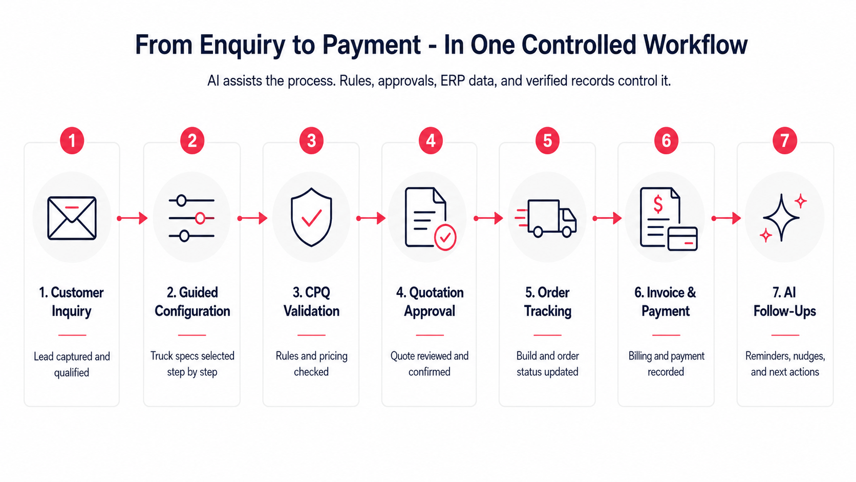
Objective
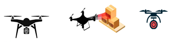
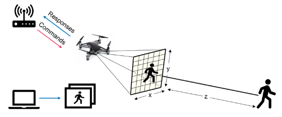
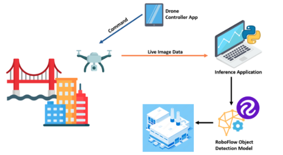
Develop an intelligent drone system capable of autonomously monitoring outdoor storage sites using GPS and navigation points. The system integrates a camera for image capture, and object detection software for product recognition (e.g., concrete pipes), and utilizes grid-based pathfinding algorithms for efficient coverage. The primary goals are to recognize stored products, determine their dimensions, and maintain an accurate count. The collected data is updated in real time to create a grid space representation of the storage site.
Key Components
AI-Controlled Drone:
- Autonomously navigates outdoor storage sites.
- Utilizes GPS and navigation points for precise location tracking.
- Equipped with a high-resolution camera for image capture.
Object Detection Software:
- Processes captured images to identify and recognize stored products.
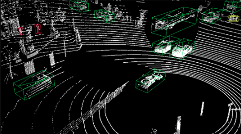
- Focuses on object recognition, particularly concrete pipes.
- Extracts dimensions and counts the number of items in each image.
Grid-Based Storage Site Representation:
- Creates a virtual grid space representing the storage site.
- Updates in real-time with information on product type, count, and dimensions.
- Provides a comprehensive overview of the storage status.
Pathfinding Algorithms:
- Utilizes grid-based pathfinding algorithms to determine the most efficient flight path.
- Ensures the drone covers the entire storage site with minimal redundancy.
Survey Routine:
- Conducts surveys twice daily for comprehensive and up-to-date monitoring.
- Systematically covers the entire storage area during each survey.
Wireless Charging Station:
- Features an automated wireless charging station.
- The drone returns to the station after each flight for recharging.
- Ensures consistent and continuous monitoring without human intervention.
Benefits:
- Improved efficiency in monitoring outdoor storage sites.
- Real-time data updates for better decision-making.
- Automated surveys reduce the need for manual inspections.
- Accurate product recognition and counting.
- Wireless charging station enhances the system’s autonomy.
Hardware Components
Drone:
- Equipped with GPS module for precise navigation.
- Integrated camera for image capture.
- Wireless communication module for data transfer.
- Collision detection sensors for safe navigation.
Charging Station:
- Equipped with wireless charging technology.
- Communication module for status updates.
Software Components
Autonomous Flight Control:
- GPS Navigation System: Manages drone movement based on GPS coordinates.
- Pathfinding Algorithms: Determines the most efficient flight path using grid-based algorithms.
- Flight Controller Software: Controls the drone’s movement and altitude during the survey.
Image Capture and Processing:
- Camera Software: Controls the drone’s camera for image capture.
- Image Processing Software: Analyses captured images for further processing.
- Object Recognition and Data Processing:
- Object Detection Software: Identifies and recognizes products within images.
- Data Processing Module: Extracts dimensions and quantity information from recognized objects.
Data Storage and Grid Mapping:
- Memory Management System: Stores and manages the collected data.
- Grid Mapping Algorithm: Creates a representation of the storage site with product information.
Survey Frequency:
- Scheduler: Manages the timing and frequency of drone surveys.
- Pathfinding Algorithms:
- Pathfinding Module: Implements algorithms to find the shortest and most efficient flight path within the grid.
Wireless Charging Station:
- Communication Software: Facilitates communication between the drone and the charging station.
- Charging Control System: Manages the wireless charging process.
System Integration:
- Main Control Software: Orchestrates the collaboration between different components.
- User Interface (optional): Provides a user-friendly interface for monitoring and control.
This AI-controlled drone system provides a cost-effective and efficient solution for monitoring outdoor storage sites, offering accurate data on product status while minimizing human intervention and maximizing overall operational efficiency.
Reference Links:
- Object Detection in UAVs is an depth Research paper that theorizes implantation for the theorized system.
Since you’ve made it this far, we feel this might interest you!